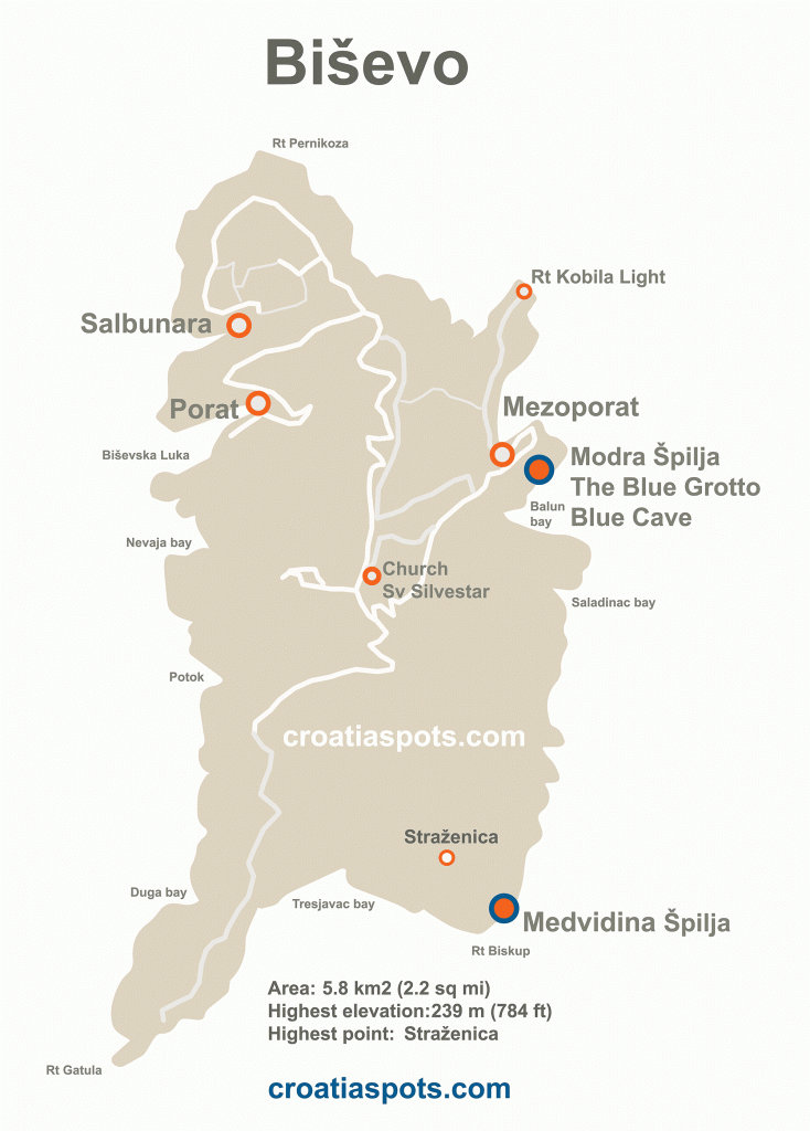
Map of Biševo Island is a visitors map to the island. It shows all main geographical and topographical points of interest on the island including settlements and ports Porat, Sablunara and Mezoporat, Church Sveti Silvestar, highest point Strazenica and most popular spots on the islands – the sea caves Medvidina špilja (Bear’s Grotto) and Blue Grotto (Blue Cave) – Modra Špilja. Feel free to download and keep for your reference – right click and save!


