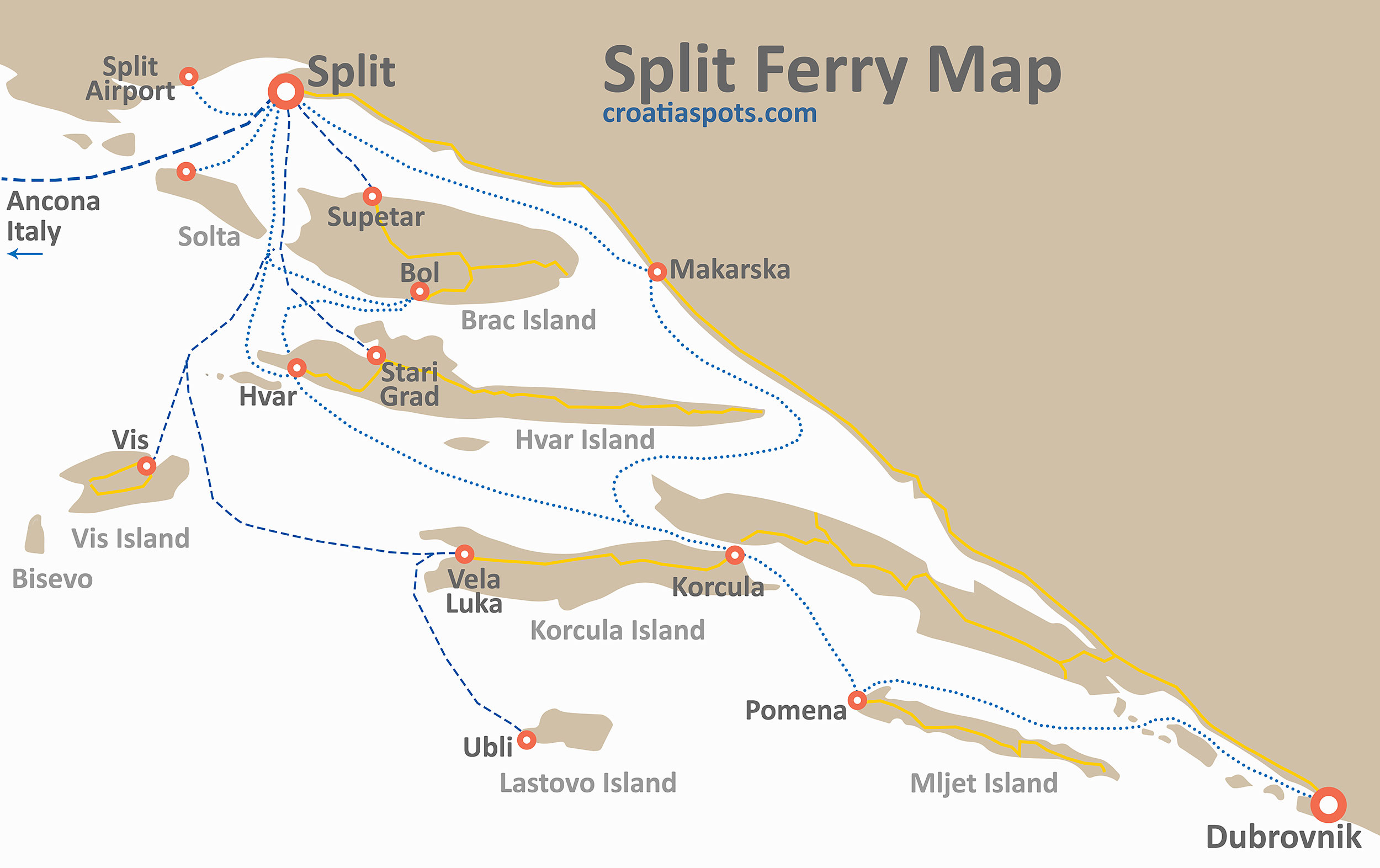
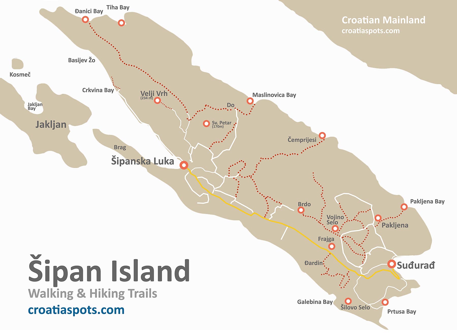
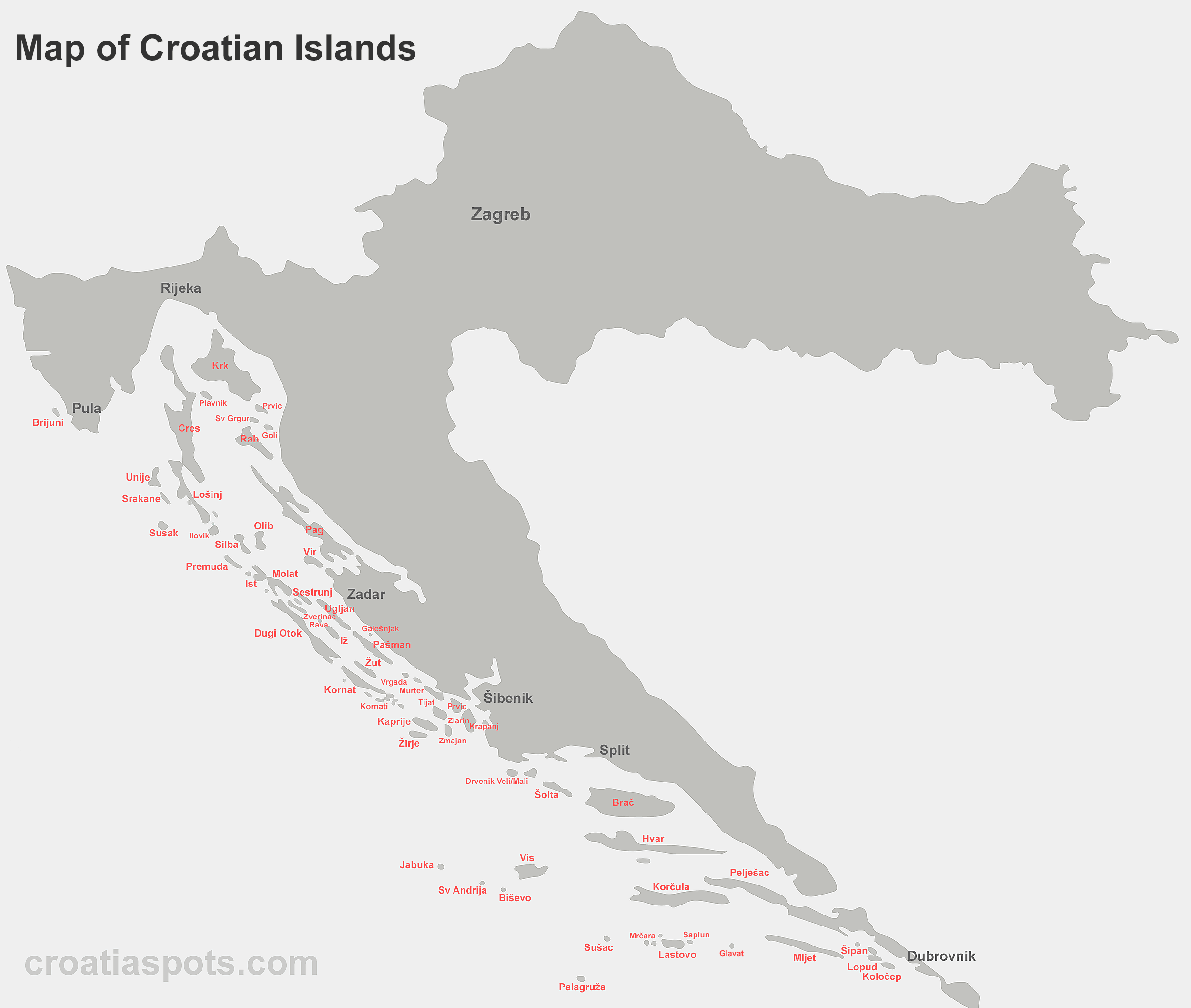
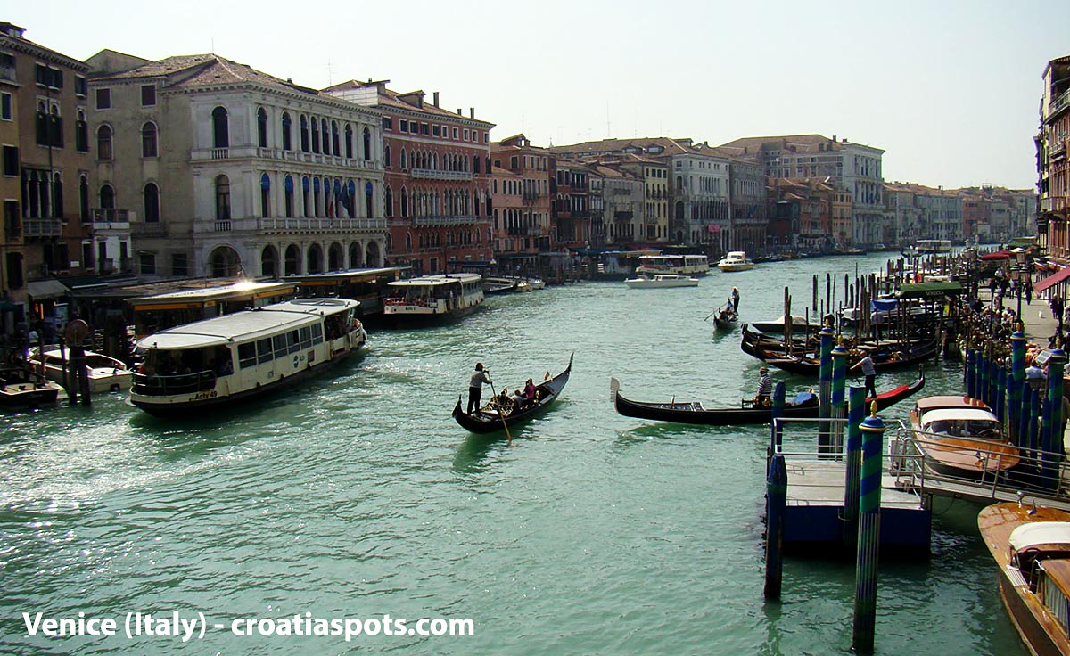
Valbiska to Merag

Valbiska to Merag is a popular car ferry crossing that serves primarily passengers traveling by car, motorcycle, or bicycle from the mainland via Krk island to the island of Cres and further to Losinj island. This ferry line (locally known as route 332) is very convenient as Krk Island is connected by a bridge with … Read more Valbiska to Merag

Dubrovnik Airport to Old Town

Getting from Dubrovnik Airport (DBV) to Old Town involves at least 4 options – you can get there by shuttle bus, local bus, taxi, or private transfer. The distance between Dubrovnik Airport (Cilipi) and the centre of the old city is 20 kilometres (12.5 miles). How to get from Dubrovnik Airport to the old town? The fastest and most comfortable option … Read more Dubrovnik Airport to Old Town

Zadar Airport

Zadar Airport (ZAD) is a small and busy airport in Croatia. Also known as Airport Zemunik, it is situated 8.5 km east of Zadar, in a small place called Zemunik Donji. The airport offers a spacious passenger terminal with good passenger facilities. Distance from Zadar airport to some popular places Place Nearest Distance by Bus Driving time … Read more Zadar Airport

Split Airport

Split Airport (SPU) is one of the busiest airports in Croatia. Also known as Airport Resnik, it is situated 24.5 km west of Split, 6.5 km east of Trogir, and is a 15-minute walk to the lovely beach. The recently renovated airport offers a spacious passenger terminal with plenty of facilities. Distance from Split airport to … Read more Split Airport

Split Bus Map

This is a map of public buses in Split that covers all bus lines. To get from the ferry port, the main bus or train station to Split Airport and back, take bus no 37 (Airport info + how early to arrive). If you are arriving at the ferry port and need to go to … Read more Split Bus Map

Hvar Beaches

Map of the best beaches on the island of Hvar Where to find the best beaches on the island of Hvar in Croatia – a handy map with references to numerous popular beaches and swimming spots on this popular Croatian island. We also added on the map a couple of popular beaches that are situated … Read more Hvar Beaches

Lopud Island Map

Map of Lopud island walking/hiking trails, bays, beaches and swimming spots This Map of Lopud island, Elafiti archipelago near Dubrovnik shows details of walking & hiking trails, location of numerous places of interest, bays and swimming spots including the highest peaks on the island – Polacica (216m) and Balakovo (197m), location of popular Sunj Beach and Uvala Male and Vele Bige bays. … Read more Lopud Island Map

Kolocep Island Map

Map of Kolocep walking/hiking trails, bays, beaches and swimming spots This Map of Kolocep island, Elafiti archipelago near Dubrovnik shows details of walking & hiking trails, location of numerous bays and swimming spots including the highest peak on the island – Kriz (125m), location of popular Blue Cave, Bezdanj, Ratac, Uvala Bige and Sapluni bay … Read more Kolocep Island Map

Šipan Island Walks

Walking Map of Šipan Island Walking/Hiking on Sipan This walking map of Šipan island shows several hiking trails as well as locations of some of the best beaches on the Island such as Prtuša bay as well as remote & secluded Đanici and Tiha bays. One of the best islands walks is probably one from Šipanska Luka … Read more Šipan Island Walks

Map of Croatian Islands

Above map: Detailed Croatian islands map with the main 63 Croatian islands Map Dimensions: 2500 × 2114 pixels. Feel free to download it for your reference.  See other Maps of Croatian Islands