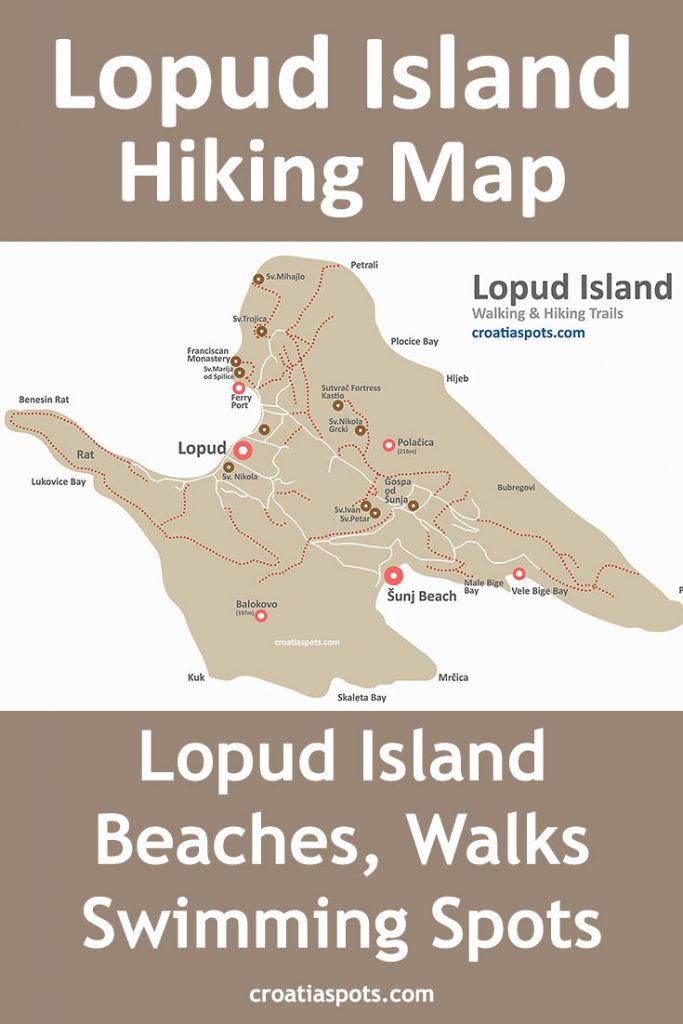
Map of Lopud island walking/hiking trails, bays, beaches and swimming spots
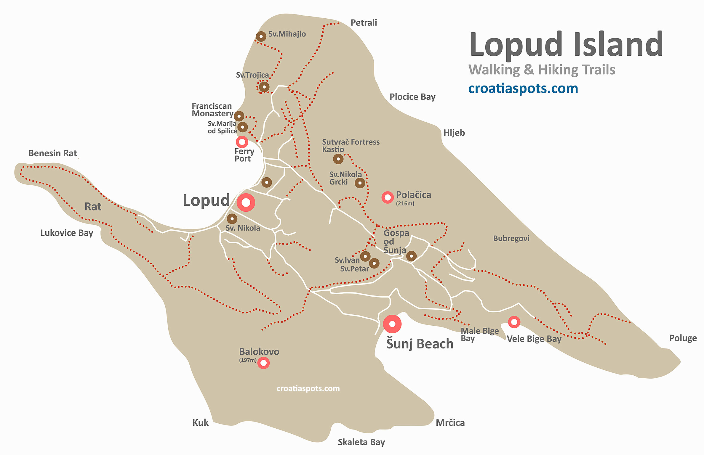
This Map of Lopud island, Elafiti archipelago near Dubrovnik shows details of walking & hiking trails, location of numerous places of interest, bays and swimming spots including the highest peaks on the island – Polacica (216m) and Balakovo (197m), location of popular Sunj Beach and Uvala Male and Vele Bige bays. It also shows locations of Gospa od Sunja, Franciscan Monastery, Churches Sveta Marija od Spilice, Sv. Mihajlo, Peta and Ivan and many more. Click on the map to see a large version, right-click and save.
Šunj Beach Location @ Lopud
Location of the popular sandy Šunj Beach is on the south-east coast of the island, in the deep and sheltered bay of Uvala Sunj (see it at the lower part of the map); GPS coordinates: 42°40’48.9″N 17°57’07.5″E (see it on Google maps)
Find out more about Lopud’s neighbouring Sipan Island (map) and Kolocep Island (map) in Elafiti Archipelago and see other maps of Croatian Islands