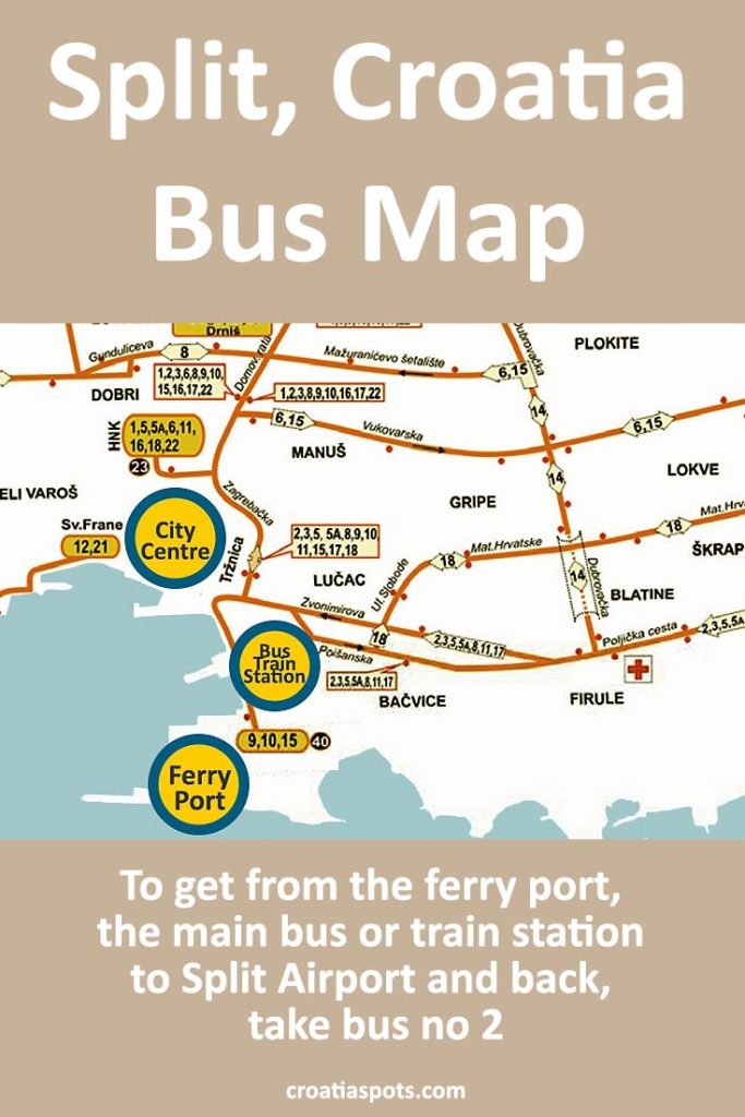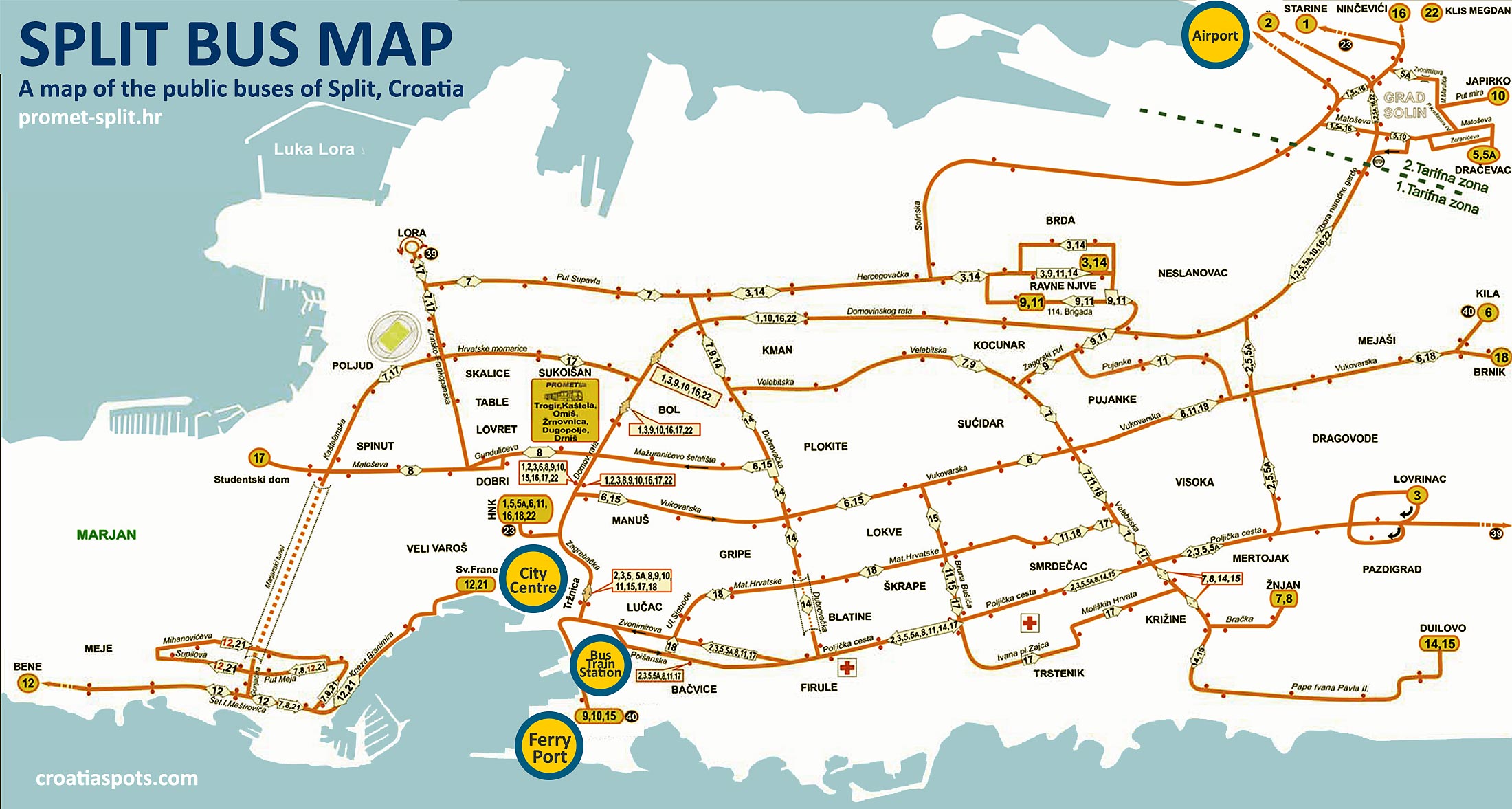
This is a map of public buses in Split that covers all bus lines. To get from the ferry port, the main bus or train station to Split Airport and back, take bus no 37 (Airport info + how early to arrive). If you are arriving at the ferry port and need to go to your accommodation, get to Trznica station (on the above map it is on the right-hand side of the “City Centre” sign) and from there you can get most of the local buses to a specific city neighbourhood. Bear in mind that the city centre and Diocletian Palace are pedestrianised areas. Find all details at promet-split.hr website.